
The third volume, supervised by Shinichi Kitaoka and edited by Takao Komine, describes how unprecedented economic challenges of the Heisei era shaped Japan.
A trove of official Japanese and American postwar maps provides overwhelming evidence that Takeshima has historically been recognized as Japanese territory.
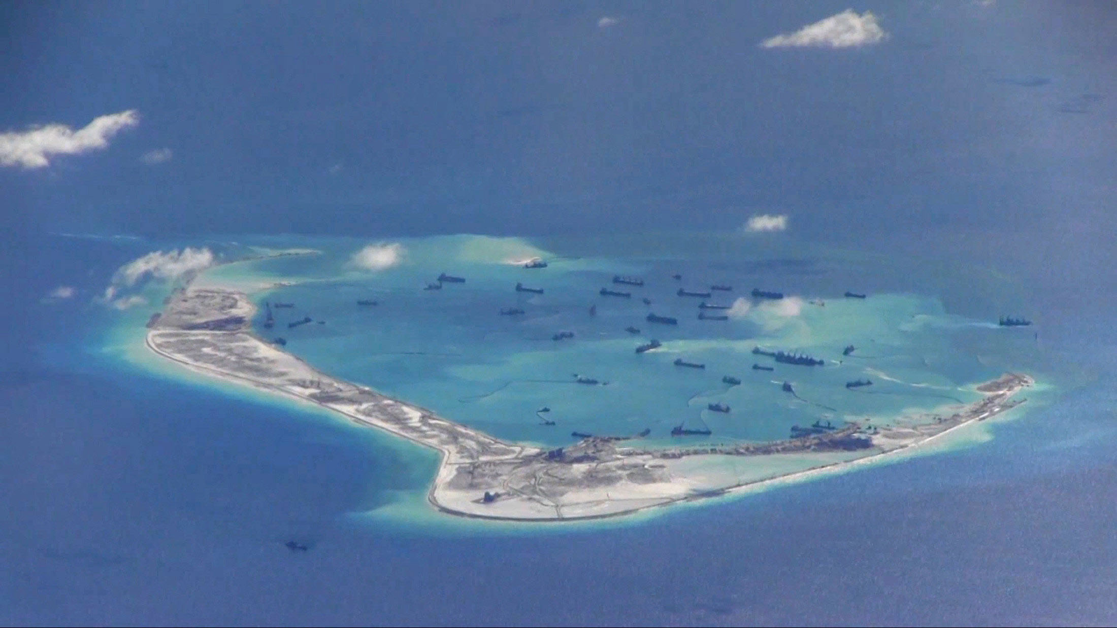
Large democracies with shared values need to take steps together to counter China’s predatory practices of economic and military intimidation that put the future of small...
“These two maps reveal the U.S.’s geographical awareness at that time in history.”
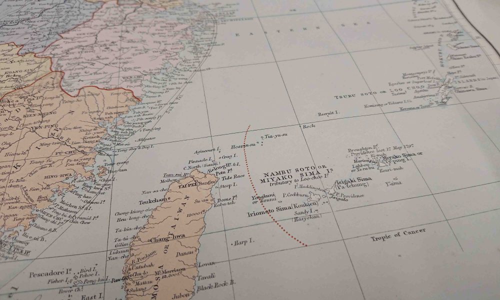
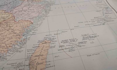

Both maps in question clearly show the demarcation line for Japanese sovereignty lying between the Senkakus and Taiwan. “The maps reflect the most up-to-date information the...
The Takeshima islets of Shimane Prefecture were illegally seized and are currently occupied by South Korea. The United States’ aeronautical charts recognize Takeshima as part of...